The Line in the Hedge: Six Boundary Walks That Explain a Family's Disappearance
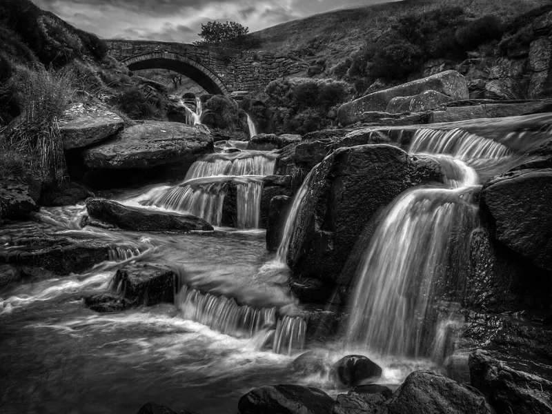
Photo: Brian Deegan , CC BY-SA 2.0, via Wikimedia Commons
There is a particular kind of family history frustration that goes like this. Someone is baptised in a village, appears in two censuses, and then is simply not there. Three miles away, in a different set of indexes entirely, they reappear with the same name, the same age and the same slightly unusual occupation.
It feels like a disappearance. Usually it is a boundary.
Parish edges, county edges and estate edges decided who kept the register, who paid the poor rate, which court dealt with the will and which newspaper reported the wedding. Move a few fields and you have changed your archival universe. Anyone who has searched a county record office in vain for a family who lived within sight of the county town knows the feeling.
So here is a different sort of day out: walk the line first, then read the records. The ground tells you what the catalogue cannot.
Three Shires Head, where the Dane divides three counties
The River Dane tumbles over a packhorse bridge at a spot where Cheshire, Derbyshire and Staffordshire meet. It is a small, lovely, slightly absurd place — three counties at a waterfall — and it is a perfect introduction to the idea that jurisdiction is a physical thing.
Walk in from the Gradbach or Clough House side, allow an hour or two, and bring the relevant parish maps. Three county record offices, three sets of indexes, three poor law unions, and a family farm that might sit in any of them. Once you have stood there, the phrase 'search neighbouring parishes' stops being advice and becomes obvious.
High Cross and the long straight edge of Watling Street
The Roman road that runs north-west from London became, for long stretches, a county boundary — and boundaries that follow straight lines are unusually easy to read. Near High Cross in Leicestershire the old road marks the meeting of counties and the edge of historic parishes, and the A5 still traces the line.
Pick a stretch and walk it. Note how the parish names change on either side, and how a farm can be nearer to a church it does not belong to than to the one it does. Registration districts, poor law unions and dioceses did not always agree with each other, and that disagreement is where ancestors fall through.
Offa's Dyke above Hay-on-Wye
An earthwork built to separate two peoples is now a path, and for family historians it marks the most consequential boundary in Britain: the one between England and Wales. Different laws, different courts, different archives — The National Archives at Kew for one side, the National Library of Wales at Aberystwyth for the other.
Walk a section of the dyke on the ridge above Hay and you can see the logic of it: high ground, long views, a line that could be held. Then go and check which side of it your people were recorded on. A farm a mile from another farm may sit in an entirely different national collection.
The park pale at Ashridge
Estate boundaries are the quiet ones. A wall, a bank, a line of ancient trees: the edge of a landed estate governed everything from grazing rights to which manor court you attended. Ashridge, on the Hertfordshire and Buckinghamshire border, gives you miles of boundary walking through beech woods, with the old park pale and estate edges still legible in places.
This is where you learn to read the difference between a parish and an estate. Estate records — rentals, surveys, maps — can name a tenant who never appears in a national index. If your family were tenants rather than owners, the estate is where the detail lives.
Beating the bounds: the parish walk you can still join
Rogationtide boundary walks survive in plenty of parishes, with the old custom of beating the bounds still performed with sticks, and occasionally with boys held upside down at the marker stone. It is one of the few folk customs that is also a piece of practical map-reading.
Find out whether your parish of interest still does it, and if so, join. Otherwise, download the tithe map and its apportionment — mostly drawn up between the late 1830s and the 1850s — and recreate the circuit yourself. Boundary stones, hedges and streams were the markers; the apportionment tells you who occupied each plot when the map was made.
The dragons around the City of London
The City has its own boundary posts, marked with dragons, and its own history of jurisdiction to match. For anyone researching London ancestors, the distinction matters: City parishes and their records sit apart from much of the material held at the London Metropolitan Archives, and the City's own institutions kept their own books.
Walk the edge from Temple Bar round towards the river and back, and you are tracing a line that determined which court dealt with a debt, which parish buried a child, and which set of indexes you should have started with.
Read the line before you open the laptop
A practical sequence works better than a random one. Begin with a boundary map — the parish boundaries on a good historical gazetteer, or the first edition six-inch Ordnance Survey, both widely available free online. Add the tithe map if it exists. Then, and only then, order the documents.
Remember too that boundaries moved by law. The local government reorganisation of 1974 redrew counties wholesale, and the unitary authorities of the 1990s redrew them again. An address written in 1901 may sit in a completely different record office today, and the indexes will not always warn you.
What a boundary explains, and what it doesn't
It is worth being honest about the limits of this. A boundary explains why a record is filed where it is. It does not explain why a family moved. People shifted for work, for marriage, for a better cottage, for a bad harvest, for an eviction, for a hundred small reasons that leave no trace in a catalogue.
What the walk gives you is humility, and a map. Standing at a hedge with a tithe map in your hand and the wind coming across a field is a useful corrective to the fantasy that ancestors were tidy. They were not. They simply lived inside a system of lines, and occasionally stepped over one — and the paper followed them, or didn't.