The Oldest Address Was a Field: Six Tithe-Map Walks for Family Historians
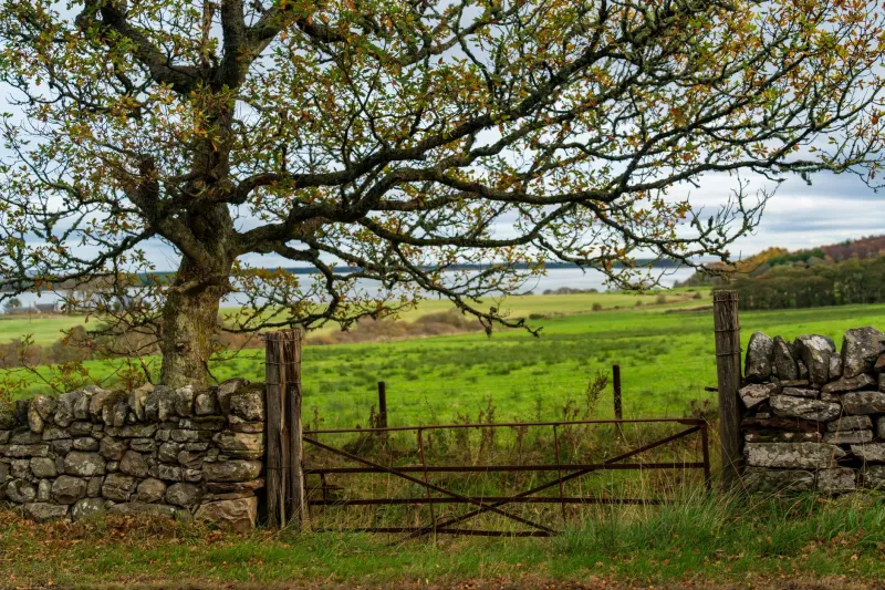
Most family historians look for addresses in towns: a terraced house, a court, a yard, a street that still bends the way it did in a photograph. In the countryside, the address was often a field. Your ancestor might appear in the records not at 4 Mill Lane but as the occupier of plot 217, a place called Long Meadow, held from a landowner who lived three parishes away.
That is where tithe maps earn their keep. Following the Tithe Commutation Act of 1836, parishes across England and Wales were surveyed so that tithes paid in kind could be converted into money rents. The result was a map and an apportionment: a schedule listing each plot, its landowner, its occupier, its field name, its acreage and its state of cultivation. For anyone with rural roots in the 1830s or 1840s, it is one of the most intimate records available. It does not tell you what your ancestor felt or believed. It does tell you which field they worked, which hedge they knew, and which name they used for a piece of ground that may still be there.
Start with the apportionment, not the map
The map is the seductive part. The apportionment is the useful part. Ask for both. The schedule is usually arranged by plot number, with columns for owner, occupier, name of land and state of cultivation. Find your surname in the occupier column first. Then note the plot number and turn back to the map. A field called Little Croft or Barn Close may mean nothing on its own, but attached to a name and a farmstead it becomes a small anchor.
Field names are clues, not confessions. A Pightle is often a small enclosure. A Hopyard suggests hops, or at least a remembered hop ground. Long Meadow, Great Ground and Little Croft describe shape and size. Names such as Poor's Piece or Church Close can hint at ownership or parish use. None of these names proves an occupation by itself, but together with the apportionment they can explain why a family stayed, moved or disappeared from the rate books.
A simple method for one ancestral field
- Fix the parish. Use a census entry, a baptism, a marriage or a burial to identify the place your family actually lived. A market town may be the registration district, not the parish.
- Find the tithe records. Search The National Archives' Discovery catalogue, the county record office catalogue, or the online tithe map collections. TheGenealogist holds a large national collection; the National Library of Wales has Welsh tithe maps online. Not every parish is digitised, and not every map survives.
- Look for the surname in the apportionment. Start with the occupier column, then try the landowner column. A labourer may appear only as an occupier of a cottage and garden, while a farmer may hold several plots.
- Write down the plot number, field name and acreage. Photograph or download the map section. Do not rely on memory.
- Match the old plot to a modern map. Field boundaries change, but lanes, footpaths, streams and farmsteads often survive. Use a current Ordnance Survey map and the local rights of way network.
- Walk only on public footpaths, bridleways, roads and open access land. A field on a tithe map is not an invitation to cross private land.
Six parishes to try
Lacock, Wiltshire
Start at the Wiltshire and Swindon History Centre in Chippenham and ask for the Lacock tithe map and apportionment. The village itself gives you an easy route: church, abbey gates, the River Avon and the lanes behind the High Street. Look for meadow and close names beside the river. The tithe apportionment can show which local families occupied the smaller plots around the village, even when the landowner was a larger estate. Walk the public paths at the edge of the village and read the field names before you go. The point is not to find a plaque. It is to see how a family's working world was divided into named pieces.
Chiddingstone, Kent
Kent History and Library Centre in Maidstone is the archive starting point. Chiddingstone and the lanes towards Chiddingstone Causeway make a good half-day walk, with church, village street and field paths. In this part of Kent, look for names connected with hops, orchards and small enclosures. If your ancestor was a hop picker or a smallholder, the apportionment may place them on a plot whose name has vanished from modern maps but survives in the schedule. Take the tithe field name with you and see whether the shape of the boundary still makes sense on the ground.
Selworthy, Somerset
Begin with Somerset Heritage Centre in Taunton. Selworthy Green and the paths towards Allerford offer a gentle Exmoor edge walk, with cottage gardens, pasture and wooded combe. The tithe apportionment is useful here for separating the small occupiers from the estate land. Field names may describe slope, enclosure or use. A name like Higher Close or Lower Ground is not romantic, but it is practical: it tells you how a community thought about its land. Match one plot to your surname, then walk the public path that passes its edge.
Great Tew, Oxfordshire
Oxfordshire History Centre in Oxford is the place to start. Great Tew is an estate village with a strong visual identity, but the tithe records take you behind the postcard. Ask for the apportionment and follow one surname through the plots. You may find a cottage and garden, an allotment, or a few strips of pasture held from the estate. The walk itself can be short: church, village lanes and public paths around the edge of the parkland. The value is in the comparison between the neat estate landscape and the working plots listed in the schedule.
Castle Acre, Norfolk
Norfolk Record Office in Norwich holds the archive starting point. Castle Acre is famous for its priory and castle earthworks, but the tithe map lets you read the surrounding fields as a working landscape. Walk the public paths towards the Nar Valley and look for close names that echo older land use. A field called Priory Close or Church Field may not be medieval, but it shows how later farmers kept older names alive. Use the apportionment to see who occupied the land around the ruins in the 1840s, then walk the same lanes with that list in hand.
Clun, Shropshire
Shropshire Archives in Shrewsbury is the starting point. Clun and the surrounding valley give you a proper borderland walk, with steep lanes, water meadows and views towards the hills. The tithe apportionment can be especially useful where farms were held with scattered parcels. Match a surname to a plot, note the field name, and then use the public footpath network to pass the boundary. Do not expect the name to be painted on a gate. Expect instead the quieter satisfaction of standing on a path and knowing that a schedule made in the 1840s once fixed that place to your family.
The map is a snapshot, not a family tree
A tithe map will not prove a relationship. It will not tell you why a family left, or whether the field was good land or bad. What it can do is give you a place to stand. It can turn a vague phrase like 'agricultural labourer' into a named close, a plot number and a boundary you can follow on a winter afternoon. That is a modest kind of heritage travel, but it is often the most honest. You are not visiting a house your ancestor owned. You are walking a landscape they knew by name.
Before you go, check archive opening hours and order documents in advance where possible. Take a pencil, not a pen. Wear boots that can handle a wet field edge. And leave the gate as you found it. The field names were the address; the walk is how you read it.